
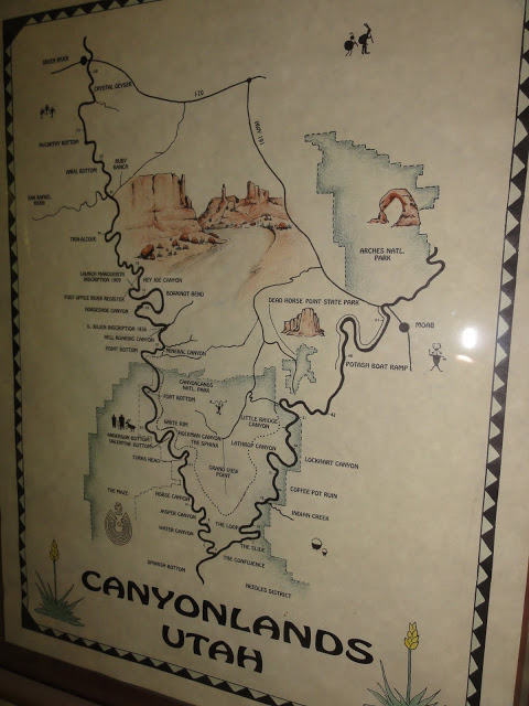
River Rafting: Canyonlands
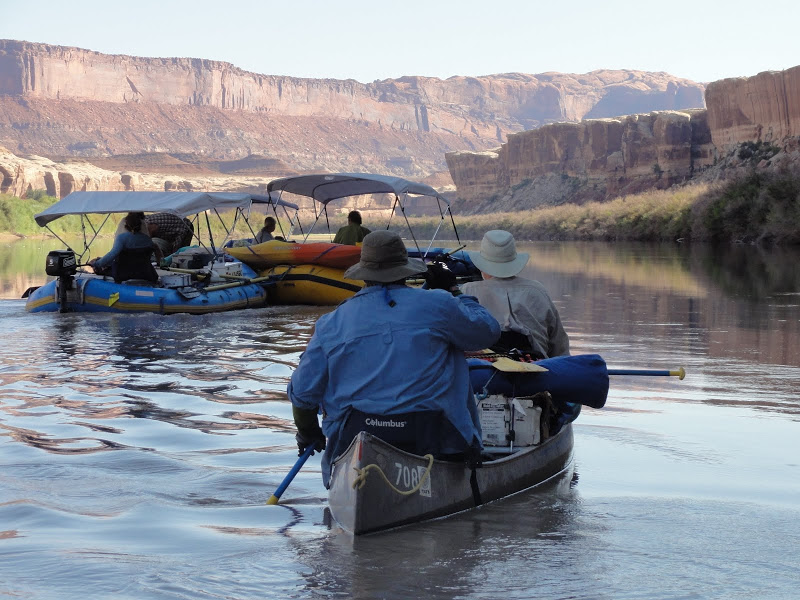
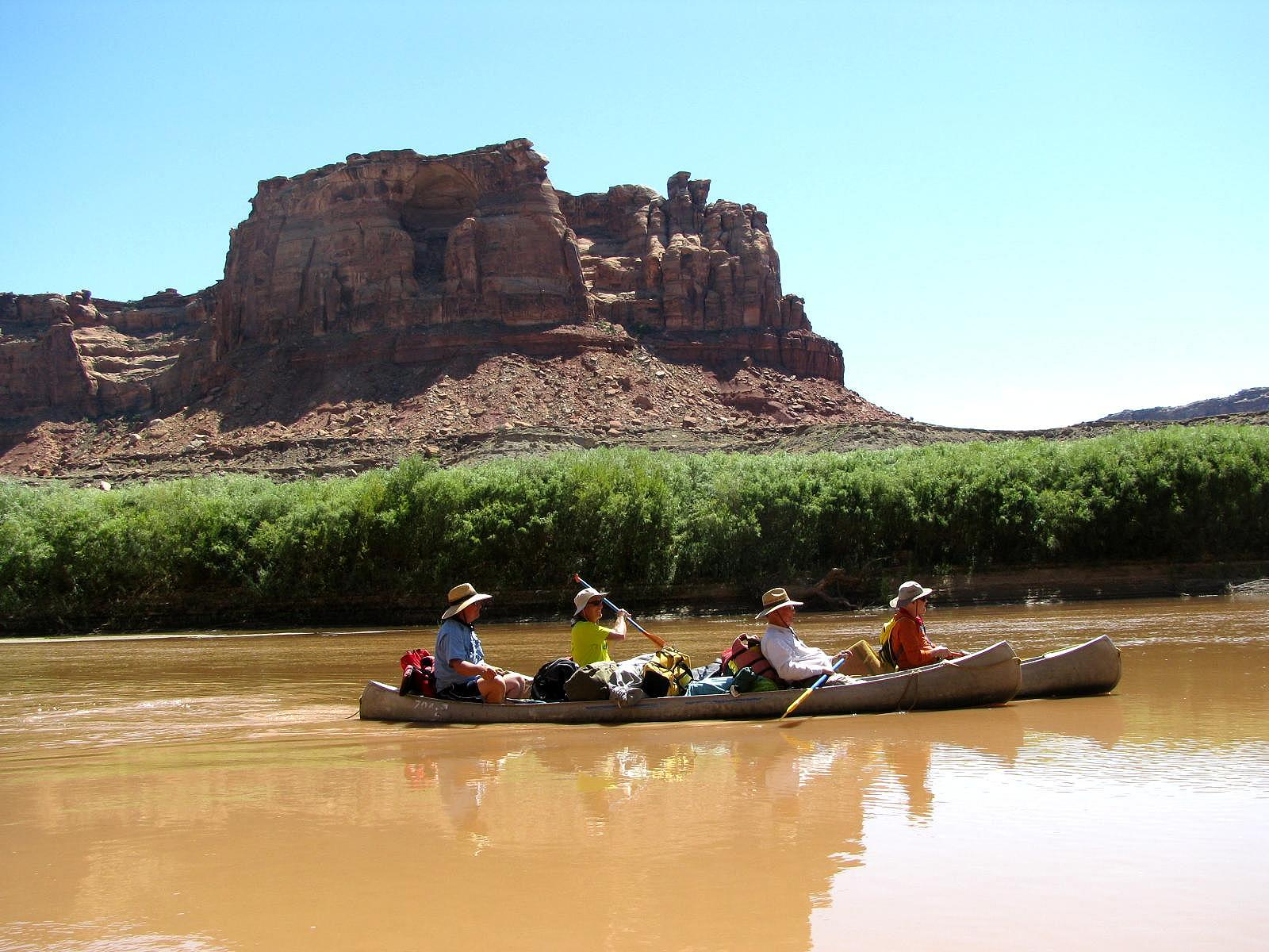
Eric Hagquist planned our canoe trip in Canyonlands to perfection. From the “gourmet” freeze dried food, to the shady lunch spots and picturesque campsites, it went like clock-work. We journeyed on the Green River in southeastern Utah from Mineral Bottom to Spanish Bottom and the Green’s confluence with the mighty Colorado River. The trip was early September of 2012. Many of the paddlers were graduates of San Jose State (SJSU), and they invited their fathers, brothers, neighbors and friends, which created a congenial social mix. Eric and the other SJSU grads were all members of the Sigma Chi fraternity, which made them brothers in spirit and tradition. We started in Moab, Utah, with a dinner at Zax’s Pizza & Watering Hole to meet the others and for Eric to collect the trip fees. The plan was to paddle for five days, averaging about 10 miles of navigation a day, eat like kings (maybe even better), do some hiking in the side canyons, and take a return jet boat ride back to Moab. We knew we were in for a great trip. It was Labor Day weekend, and we were all to meet at Tex’s Riverways headquarters on the edge of town.

Hit Bottom
Before the trip, I took Scott Soper’s list of “must have items” and had made my obligatory trip to REI to freshen up my gear: new tent, new cup, new headlamp, waterproof bags, etc. I also bought a map of the area we were about to paddle. As I surveyed the map of Canyonlands and the Glen Canyon National Recreation Area I immediately hit bottom. Every entry I saw along the edge of the rivers made a reference to a BOTTOM. I had some research to do to figure out why the mapmakers kept referring to the areas as bottoms because they were ubiquitous: Saddle Horse Bottom, Tidwell Bottom, Horse Thief Bottom, Potato Bottom, Upheaval Bottom, Fort Bottom, Hard Scrabble Bottom, Beaver Bottom, Queen Anne Bottom, Unknown Bottom, Valentine Bottom, Tuxedo Bottom, Arla’s Bottom, Spanish Bottom, Point Bottom, Mule Bottom, Binky Bottom, Tent Bottom, and Cabin Bottom among others, and these were just in that small area of southern Utah.
As I pictured them in my mind, the Bottoms were continually changing and morphing. After every winter snowfall comes the spring thaw and with every summer storm flows the rimrock flooding. The rushing water would wash new sand and soil into the canyons and down to the streams. The streams flow into the rivers, and river meanders in its serpentine fashion, carrying its payload of sand and silt as it moves. Sand banks from the last high water are swallowed by the seasonal water flows and carried further downstream, where they disappear, re-form and expand.
There is very little arable earth in the river basins, except for what gathers with the sand and dirt as they are deposited along the inner edges of the river contours. In these sand banks the wind-blown seeds are washed, germinate, and find root. Many plant shoots are eaten by bugs and animals, before they find root again and struggle for a hold of the fragile land spit.
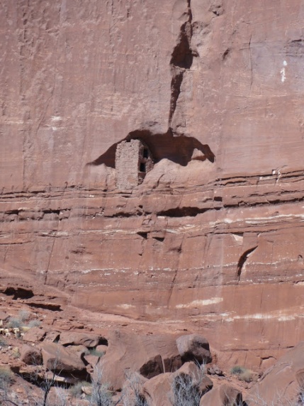
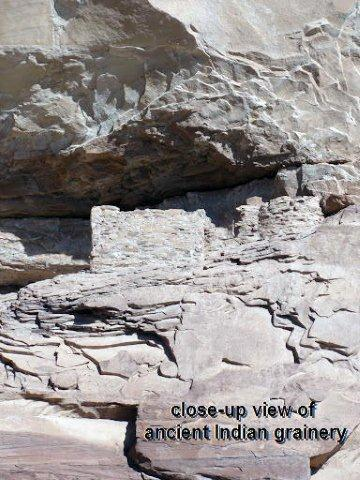
Generations ago the bottoms were planted with crops like potatoes and corn, because the rich soil was full of the nutrients and minerals that made for bountiful harvests. We discovered granaries in the cliff walls, so we know this is true. The only places where a river boatman can land are on one of these “bottoms,” so plants are competing with humans for space to survive as well.
The bottoms look to be so full of life; it is hard to focus on anything but the wonder and majesty of these barren cliffs and fecund rivers of the region. What is more beautiful than rising sandstone cliffs, carved out by thousands of years of river runoff, varnished by the action of the water and the minerals glistening on the rock face? The red sandy water seems so lazy and perpetual, and the natural arches first at a distance suddenly pop up right in from of you. Such odd places of grandeur the cliff face. We are approaching a lunch-spot bottom right now, yet my mind is upstream.
Growing up in Maryland, as a boy I had a good buddy during our “Rockland” days named Brock Johnson. On lazy, hot summer days Brock and I used to walk to the Rockland pool and dive to the deep end of the murky, spring-fed swimming hole and see how long we could stay submerged. He loved staying underwater and called it “hitting Brock Bottom.” The sides of the pool slanted toward the muddy bottom; I know they slanted because I scraped my chest raw on dives more than once. Brock and I would skip stones, do laps, cartwheel off the diving board, and spend a lot of time submerged near the pool bottom. Between us he had the better lung capacity.
Years later, Brock told me about a rough patch he had run into with his wife. This chance meeting was about 20 years ago now, but I remember Brock saying how much he loved his wife. He stressed how important she was to him. He said he loved her more than anything on Earth and that he would do whatever he could, even die for her, to preserve their wedding vows. I knew how he felt. What I did not know were the circumstances that had led him to make the statement. I heard from old friends a few years later that Brock’s wife had left him and moved in with his older brother, Pierce. Brock was detached and disconsolate. His wife wanted a divorce. It broke his heart and his vow of fidelity. In a short time Brock took his own life. Wow! Such closure … such finality. He had eternally hit Brock Bottom.
No Bottom without a Top

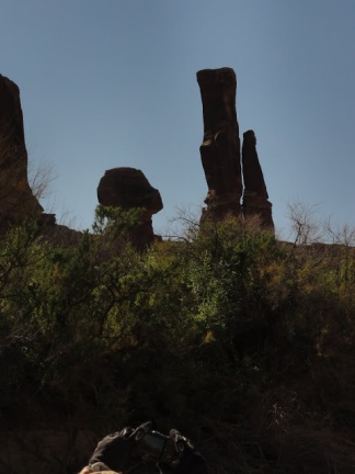
Each of the Bottoms along the river is accentuated by the rim rock. These places offer extraordinary vistas of the landscape: Bighorn Mesa, Dead Horse Point, Upheaval Dome, Dead Man Point, Tower Park, The Needles, White Rim, The Sphinx, Candlestick Tower, Turk’s Head, Murphy Hogback, Stillwater Canyon, Pete’s Mesa, Beehive Arch, Lens Canyon and the Cataract Canyon on the Colorado River. These geological outcroppings are inexorably carved and broken by wind, water, ice and erosion, and find their way to the river.
The Green River 
Rather than being green as depicted in the photo above, on our trip the Green River was constantly muddy and milky. We made our slow and deliberate expedition back in geologic time, where the days are measured by sun and heat, cool water and bottoms, shade and noon temperatures. We were in the wilderness on an unguided trip through Utah, south of what John Wesley Powell called Flaming Gorge but north of the magnificent Colorado River. The Green is a Class One river during this 50 mile stretch, with no perceptible rapids to speak of.

The references to Cataract Canyon bring to mind the Cottonwood Gulch Foundation and the summer expeditions they lead in this part of the country. When I was in my teens, I was in one of the Prairie Trek Expeditions with kids from around the Four Corner States. We had a counselor at the camp who was a writer and guitarist, his name is Rick Madden. One summer, 101 years after the original trip Rick wrote a song, with the help of two other counselors (Mason Rees and Peter Abrons) called Geologic Time. The song chronicles the trip taken by John Wesley Powell as part of the US Geological Survey of the Grand Canyon. No one had authoritatively recorded the Colorado River, as much was held in superstition and folk lore. That famous trip, taken in 1869, was taken by those ten brave men in wooden dories. One verse is etched in my memory: “Through Echo Canyon and Marble Gorge to Separation Canyon Blues. Three men leave those three men die, leaving seven to carry through.”

We did not travel in wooden dories and we did not face danger. All 18 of us made it safely during our trip, and we will again. The good fortune, though, is that we had several experienced boatmen, three of whom had been on this same trip up to 5 times. We did not run into any problems on our trip to speak of, however, having steady boatmen on our side, put my mind at ease: we did not have to be in constant wonder as to what was around the next bottom or bend in the river.
Hatch River Expeditions
When I was eight years old, my family went on a float trip down the Green River from “The Gates of Lodore” in Dinosaur National Park to Split Mountain Gorge. We were guided by the Hatch River Expeditions, who were founded by one of the early rafting pioneers of the Green, Yampa, and Colorado Rivers. The rapids were exhilarating and challenging, even with a guided boat.

At the end of our 2012 Green River trip, Gerry Alkema, Ed Basehart, and I stopped in the town of Green River to buy a melon and see the J. W. Powell River History Museum, which was surprisingly full of interesting exhibits. One section, dedicated to the original river guides, honored Gus Hatch as a member of the River Runner Hall of Fame.
My father recalled that our family had gone on two trips with George Henry, an experienced river guide with the Hatch Expeditions. The fact that I have some vivid memories of that trip, nearly 50 years after it happened speaks volumes. One of my memories is setting up camp and walking with another boy about my age up the slope overlooking our camp. I think the kid’s name was Arnold. As Arnold and I gained a great perch to see the campsite and the river, we spotted a huge cat running through the campsite below. I saw it run right between my parents as they were laying down their sleeping tarp. We ran back down the hill to the camp just in time to hear the first hand exhilaration about “the mountain lion” that had been within a whisker of my mom and dad. It went by so fast, they were not sure what it was. Arnold and I knew for sure. What a close call!

Portland to Salt Lake City
Gerry Alkema and I were about an hour delayed in Portland on our flight to Salt Lake City. The delay gave us time to talk about Hood to Coast, a crazy 200 mile relay race, and the upcoming trip to Moab. The hitch was that we were supposed to meet up with Gerry’s father’s good friend, Ed Basehart, who was flying to Salt Lake City from Tallahassee, Florida. Ed’s flight was expected in SLC around the same time we were scheduled. Ed would have to wait at the baggage claim until we arrived. Ed had badly injured his foot years ago. In the orthopedic operation, he lost several inches to his leg and needed a 3″ lift in his boots and shoes to walk evenly. Gerry’s statement to Ed to “cool his heels” until we got there was met with a laugh at the irony of the request.
When we finally met up with Ed at the Southwest baggage claim, he was waiting patiently. After too long a wait in the car rental line, we drove the special Enterprise family rate vehicle (Gerry’s son works at Enterprise) out of the lot. We headed south through Provo to Price, Utah, on our way to Moab.
Taking personal control of the driver’s duties, we had a beautiful vista of the Great Salt Lake Basin. The mountains are so close to the urban areas, it takes no time at all to be in the wild. As we headed east toward Canyonlands and Arches National Parks, we were hit with a tremendous rain storm. Our view of Price was as obliterated as the road on that trip. I followed the lights of the truck in front of us and stayed wide right of ongoing traffic. The highway’s white lane lines were impossible to see. The lightning strikes, down pours and gully washers were every few minutes. We slowed down to be safe. We kept on truckin’ though and made pretty good time to Moab.

Moab, Utah
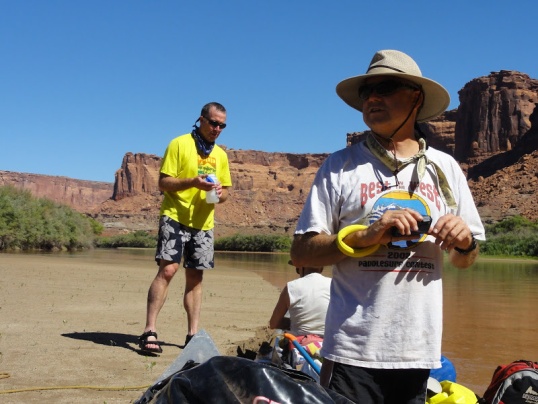
We checked into the Motel Super 8 (bikes not allowed in these classy rooms) and dropped off our bags. Zax’s Pizza & Watering Hole dinner consisted of soup, salad and made-to-order pizza. A few of us ordered pitchers of beer to wash down the local fare. Some pizza slices were better than others. We met the other members of the Green River group, paid Eric Hagquist what we owed for the trip, and met Eric’s father, Gerry. I knew that Gerry Hagquist must be a character from the e-mail he sent to us, his fellow River Rats, just before our trip:
Dear Canoers,
I’ve lost the original e-mail message, but recall that several old ducks (aged 80 and down) are going on our trip. I’m very disappointed! I have 82 years and fully expected to have respect from all of you for my advanced age. I expect to ride the whole way, no walking in shallow water when Eric directs me down the wrong channel. I sure don’t want to share glory of my advanced age with several ‘pretenders.’ Again, in camp, when food is served I expect the deference you would give the US President — no sharing!
What I really expect is a bunch of young fellows to gently guide me down the 50 miles of the Green River through Stillwater Canyon. In return I may give renditions of short bawdy poetry after evening meals. My repertoire is small; lucky you.
I’m looking forward to the excursion and to meeting you all,
— Gerry Hagquist (Eric’s ancient Dad)
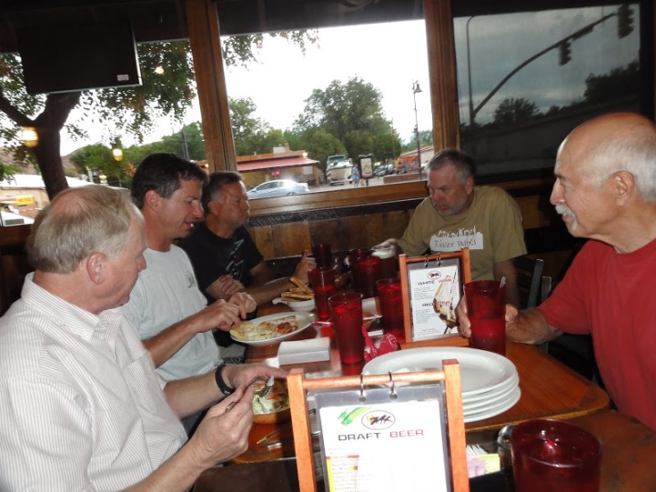
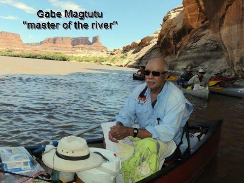
Another guy we met at Zax’s was Gabriel Magtutu. He had a scratchy voice, so I knew he had some sort of voice box challenges. He sounded like a guy who I knew who had Teflon sprayed on his vocal chords. Gabe grew up in the DC and Bladensburg, Maryland area. He had been a boxer as a young man and he said he followed the snow storm west, settling in Montrose, Colorado. He skied and was on the ski patrol in Telluride, Colorado. He will have lots of stories to tell, no doubt.
Labor Day was on September 3 this year. It was Eric Hagquist’s 29thy wedding anniversary and he was spending it with his father and fraternity brothers. I asked him about his choice and Eric replied, “My wife knows, and she understands. Besides I left a sweet anniversary card under her pillow. She knows I love her.” If it were always that simple and easy!

We assembled at 7:30 am at Tex’s Riverways and loaded up the vehicles to drive to Mineral Bottom. The ice bags, block ice, t-shirts and maps were hot commodities, as a few of us made quick purchases. The Tex crew’s description of the groover took the longest time; but it was worthwhile, since we had to be particularly careful of human waste on the river. Having been on a Colorado River trip where sickness went through the group like a dose of salts, I know what it is like to get hygiene wrong. With Gabe and Galbo on the trip, plus lessons learned by all of us, we were likely to be fine.


The jimson weed was in full bloom outside of Tex’s as we loaded the aluminum canoes and gear into the trailers and vans. The distinctive red Magtutu canoe was also secured into place.

We drove a short distance on flat highway and veered off to a dirt road that made the steep descent down the sandstone cliffs to Mineral Bottom. The road had a serious wash out last year and Tex’s had lost a good chunk of annual revenue during the shutdown. They made some alternative plans for put-ins and take-outs from the river and salvaged as many trips as they could. We had heard stories of drivers walking alongside the buses and cliffhanging roads that had to be backed down in spots, so we were prepared for anything. Anything, that is but bugs.
BUGS or no bugs? 
I asked our driver if we should expect mosquitoes at this time of year and he gave me a curious reply. If the snow pack is BIG then you can predict the bugs from June to September. The more snow the worse the bugs, especially the mosquitoes. The lighter the snow pack, the fewer the bugs. “So what was last winter’s snow pack?” I asked. “Very small,” was his reply. I was happy, since I am a magnet to bugs, particularly mosquitoes. We had a few pesky sand flies chomping our ankles, but there were virtually no other biting bugs to bother us. Hurrah!

Labyrinth & Stillwater
Labor Day is the official “end of summer” for many of us. It is the beginning of school in most parts of the country. For us it was the start to our marvelously meandering trip down the Green River.

I was in a canoe with Bill Luhrs. Bill’s brother, Steve, was one of the SJSU fraternity brothers from the class of 1977. Steve is just a few months younger than I am. Bill said that, depending on the year, about 30 – 40% of the water in the mighty Colorado River, comes from the Green River. By looking at the carved walls of these canyons and the small tributary canyons that flowed into the Green, it seemed to me to be a true statement.
The Green River has its origins much further upstream in the mountains of Wyoming and Colorado, but the most awesome rock carving is in Utah. We get to feel it and live in its Bottoms for the next six days.


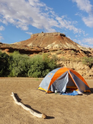
The sun was mighty strong during the day, so we covered our heads, legs, and arms with hats and sun screen. The nights were cool, so it was also good to have a jacket along for the trip. Our lunch stops aimed for several aspects: shade, enough sand to set up a table, and enough bottom to avoid steep river bank climbs.
We paddled into Fort Bottom as the evening shadows approached and found a spot on the sand bank to set up tents and designate a cooking area. Gabe Magtutu also walked us through the double hand washing routine (post-latrine and pre-dinner ablutions) that served us well.


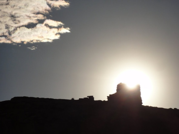
Before dinner the first night, while adult beverages were being concocted, Gabe and I set up tents and took a hike to a miner’s cabin, which was a short distance from the river. Our ultimate destination was an Anasazi lookout tower on the ridge behind our camp. I believe the Bottom was named for the lookout tower, as some believed it to be a command post in case of intruders. Neither the miner’s cabin nor the tower looked like a Fort to me, but so it goes.
Our goal was to reach the mesa top and return in time for dinner. We talked of emergency medicine and our children as we climbed an explored and hiked. Gabe knows the geology, plants and reptiles to a great degree and I enjoyed pumping him for information as we scaled the final steps to the lookout tower. Shored up with mortar and cement, you could still see the cedar vegas between the floors of the tower and there were remnants of a T shaped door about knee height. The view of the river unfolded on three sides of us, which showed us why this was an ideal watch post for the Indians who lived here and constructed the tower.

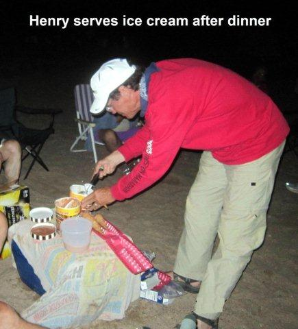
Gabe and I heard a shout from the direction of our camp and assumed it was the equivalent of a dinner bell. From where we were standing at the time, however, they should start without us. We wanted a safe return without cutting switch backs or rolling down steep slopes. Steaks, potatoes, salad and ice cream awaited us. A gourmet meal complemented by white or red wine and plenty of beer. Gabe and I got back to camp just before “seconds” were announced, barely. Mark Welch was the chef that first night and his “Steaks Diane” were cooked to perfection with their own gravy. It was a great first night feast, but was missing the cherry tomatoes.
As the sun was setting and dessert was dished out, Gerry Hagquist took over and recited and read the famous Robert Service poem, The Cremation of Sam McGee, which set the tone of toughness, loyalty, and fun befitting our trip.


The ice cream and chocolate sauce were particularly fine that night and the next morning a few of us had remnants of dessert on our faces, even after breakfast.

We got a good start the next morning and floated about a mile before we saw the other side of the lookout tower. The Green snaked its way 180 degrees and was carving out the sandstone as she went.Not long after making the bend, we saw a flotilla of rafts pass us the next day. They were under motor power moving speedily down the Green. From shouts back and forth we learned that they were in the middle of a 54 day float / rowing / motoring trip down the Colorado. They told us that they were ignoring any “no motor” rules because they were traveling so far. It was a long time to Lake Powell.
The series of buttes and mesas we saw were more and more spectacular with each river bend. One of the prettiest is called The Butte of the Cross, which is actually two separate buttes quite a distance apart. They appear to be joined as one in this photo, which we can call the John Wesley Powell view.
Horseshoes & Hand Grenades
The late afternoon skies and the sunsets were nearly as spectacular as the stars, which were so brilliant after dark. The warmth of the fire, the sound of the water, the visual acrobatics of the bats, and the glimpse of the canyon walls were comforting. It was also a lot of fun to be able to shut down the business buzz that often takes my attention in Portland and just listen. The crickets, the canyon wren, the riffles. The relative quiet is a great stress reliever.

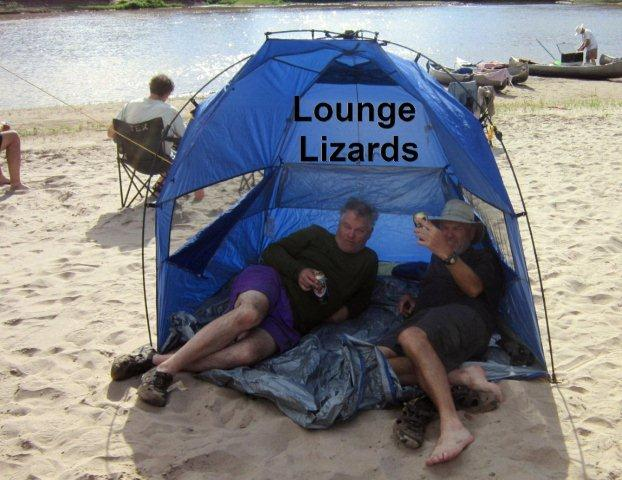
Gabe brought along a horseshoe set, which he set up in our campsite the second night, located at Bonita Bend. It was good to dry the sweat, bath off the day, and relax right after dinner. Then there are the stories: Gerry Alkema, Scott Soper, and Steve Luhrs were filling in the “dead spots”, which were not very often, with another SJSU story that got huge laughs at the retelling.
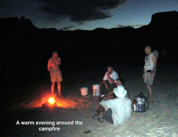
The stories get better and better all the time, no doubt. There is nothing like an after dinner fire to reflect on the day just ending, count our blessings. And get ready for the day ahead.

Doug Yoder brought out some of his toys, including an i-Pad which had the constellation app on it. We enjoyed holding it up to the stars and planets overhead and seeing the mystery of the moon, the Milky Way, and our solar system, which were putting on their nightly displays.
Desert Varnish


I have often wondered what causes the sandstone to appear so moist and shiny along the cliff faces, without any water in sight. I learned from a geology profile in Eric Hagquist’s guide books that the dark red patina is actually caused by the water in the rocks. The water leeches out the iron and/or manganese in the rocks, which form oxides. The sand, chemistry, and mineral content of the surrounding rocks give the walls their various colors: brown or black, orange or tan, rust or rouge. It certainly gives the canyons a luster! I was grateful for the explanation, though I could not find out exactly how long the process takes to give the rocks their color variations. I imagine it is many years. The walls of Stillwater Canyon gave us great views to ponder questions like these.

We had some calm water on the trip today and were able to enjoy the canyon as we progressed deeper and deeper into Canyonlands. We applied a fresh coating of sun screen, put our sunglasses on, secured our hats in place and prepared for the on-coming heat. The water temperature was probably in the 60’s but it still felt cold. The air temperature, conversely, shot up to the 80’s and the difference in the temperature when we were in the sun versus the shade was dramatic. It felt like a twenty degree differential. I could feel my lips getting drier and more chapped, so I kept some Bert’s Bees handy. That may have been a mistake, as later in the trip my lips blistered. I should have followed Gerry Hagquist’s example and put some zinc oxide on my lips instead. Live and learn.
Finding Shade
Besides my lips, I also felt my feet searing in the sun. Many of us resorted to wet towels in our laps, which we could alternate from covering the coolers to covering our legs and feet. It worked pretty will. But staying out of the sun at high noon was NOT an easy thing to do, but highly recommended.
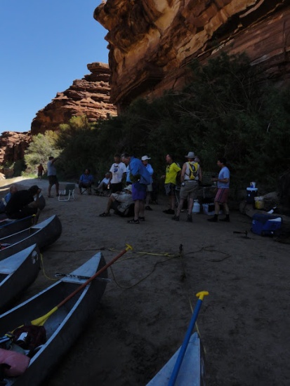
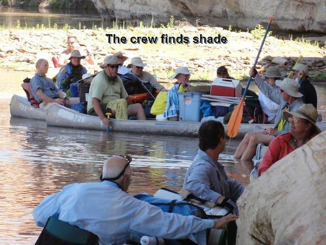
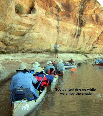
We had some very good luck on the Green this time of year. The sun is directly overhead at noon and the cliffs are straight down, for the most part. Still there are other spots which have some excellent shade, even in summer. We found one of those spots that second and again the third day for lunch.

Come See My Etchings
Eric encouraged us to take the near daily walks to break up the paddling and to get our legs moving again. I was all in favor, as my arms were getting the only work out on this trip and there were some important road races in my future. Sedentary canoeing is hardly ideal.

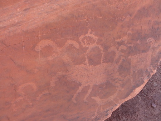
One of the hiking spots went near the river to a large monolith. On that rock were some Indian petroglyphs worth seeing and studying. We saw some other petroglyphs later near Turk’s Head. The symbols of men and bighorn sheep and shields and squiggly lines were easily identifiable, but what they actually stood for is more of a mystery.
The third day we were particularly grateful for shade, as we knew that those of us who wanted to hike would be exposed to full sun all afternoon, while we climbed up to and around Turk’s Head. Scott and Eric said that there was an option to float with life preservers around Turk’s Head, but the temperature of the water made that more conducive to hypothermia than a good time in the river.
Dead Horse Canyon & Turk’s Head

After lunch the third day, we had an exhilarating hike to the top of the mesa. The differences in the rock from the ridge top to the river are remarkable. The sandstone is hard enough to create slickrock, but porous enough to absorb some of the water. I had a pocket full of bright red rocks, which glistened in the sun like mica. It was almost like chert, a hard sedimentary stone used in making arrow heads.
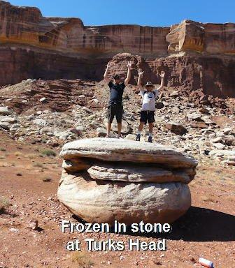
The chance to stretch our legs and raise our arms was just as welcome as advertised and those of us who made the trek got the views that were worth the effort. We did not find any dead horses, but were glad to have Turk’s hats on our heads, or any covering for that matter. The temperature spiked to near 100 on the mesa top. The cliffs in the distance were spectacular. We snapped some photos, rehydrated, and hurried back to the river.
Food
It is always good to be open to surprises, such as when the cherry tomatoes showed up long after Mark Welch’s Steak Diane and salad feast. Somehow those little red veggies had hidden themselves in a small crevasse in the bottom of Mark’s cooler. The Luhrs brothers wanted to know: “Now how did those little buggers get there? They are blocking my cold beer.”
WARNING: Beware of street fighter with a knife! Gabe was taking no shit from any of us when it came to the chow line for morning breakfast. How do you like your bacon, buddy?
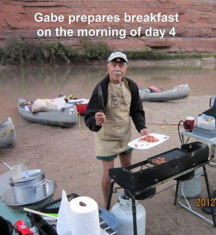
Speaking of bacon, all kidding aside the breakfasts were great. The highlights include the Soper Quesadillas, the Hagquist French toast & sausage, the Alkema scrambled eggs (with left over pulled pork and bacon bits), ham, oatmeal and pancakes … with the condiments of your choice. Once we figured out the coffee situation, the meals were less grumpy in the morning. Lunch? We had hotdogs, pears (offered until rotten), deli meat sandwiches, watermelon, pulled pork with Yoder’s secret b.b.q. sauce, macaroni and cheese, salami, tuna fish, peaches, cookies and cool aide. Dinners were hard to top after the Steak Diane, but the Luhrs Lamb, salmon with lemon mustard sauce, rice pilaf, burritos with pork, beans & brown rice, and the Rystrom stroganoff, made for a fabulous line up. Eric was able to get these meals expertly packed and refrigerated (where needed) to last the entire trip, without a flub.
Gerry Alkema, Ed Basehart and I had a disappointing final dinner at The Cowboy Kitchen in Wellington, Utah, and we longed for the river and Eric’s cooking. After you have had “the good stuff” it is hard to go back to plain pudding.
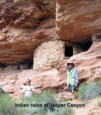
Jasper Canyon
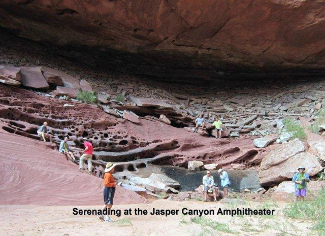

Perhaps the best hike that most of us made was the climb up Jasper Canyon and into the enormous natural Amphitheatre. The echo chamber was perfect for the singing of the SJSU men’s choir to serenade us with a few old favorites from Homecoming. It was a great place to sit in the shade, feel some refreshing water seeping down the rocks, and to see the holes that were created in the sedimentary surface. Great find!
Sand Storm

The second to last night in the canyon we had a beautiful vista down river toward the Confluence. A few bold paddlers decided to sleep without a tent under the stars. With dinner the Rystrom’s provided us with a special adult beverage selection. There were smiles all around. The pillow felt particularly soft that night until about midnight. What we had not anticipated was a storm. It began quickly, after we were securely in bed. The wind was intense enough to blow tiny particles of sand and grit into every part of our tents. Those without tents had to quickly scramble to set up shelter. Those with tents already up had to make sure that they did not blow over or roll away. Easier said than done. This night turned out to be the least comfortable for all of us. No one escaped the pelting of rain and wind and by dawn everyone discovered sand in every section of our packs and in every orifice of our bodies.
Water Canyon 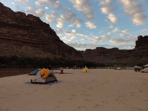
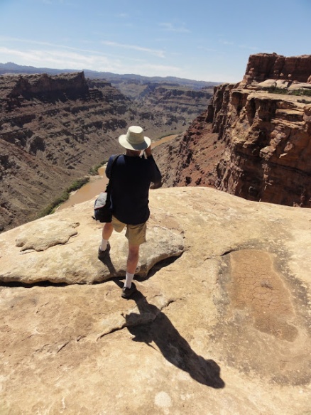
Eric Hagquist gave all of us the appropriate disclaimers about the Water Canyon hike: 1) it is steep; 2) it is hard to climb; 3) once past the canyon, the trail can be hard to find; 4) bring lots of water; and 5) did I say it was steep? How steep you ask? Apparently, once you climb up the narrow ravine, it rises nearly 1,000 feet in one quarter mile. What Eric forgot to tell us was how beautiful the view was of the Green River, once on the mesa top. We were not sure if we could see the Confluence of the Green and the Colorado from the top, but some of us were willing to try.


Gerry Hagquist was right up there with the fastest of the hikers (except for Erik Rystrom, who likes to travel at warp speed). Erik and Jock were slowed down by some wrong turns and dead ends on the mesa tops, but that offered the rest of us a change to keep up. Gerry finally decided, near the top, it was time to go back down. Jock and Erik agreed to hike some more with me to the tippy top of the mesa for a river view. We had thought it was only a mile or so further, but it was more like 2.5 miles each way. The hike was hot and very dry, but worth every step.
The entire river experience is different from above. The plants are Mormon tea, rabbit bush, juniper, yucca, and pinion pine. The wild life is jack rabbits, crows, and lizards. The sparse soil is held together by micro-organisms. It is more like a landscape out of Star Wars, with the Sand People ready to peer around the next formation.

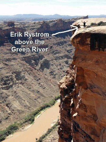
We made good time on top, Erik setting a mean pace and we zoomed to the edge for some photo ops before heading back to the river. As we completed our loop we saw Gabe Magtutu, Scott Soper, Bill Luhrs, and Mark Gambo. They were going to continue to quick march to the edge and return quickly thereafter. We will often recall the beauty of that vantage point. It was outstanding.


The Confluence
We all paddled downriver to the Confluence and located a nearly vacant sandbar to land. As Bill and I looked at the cliffs in the area, we noticed that the land seemed to slope more dramatically upward, as if they had fallen into the mesa behind them. Gabe told us that the sloping was created by salt. I thought Gabe had had too much time in the sun, but it turns out he is right. Millions of years ago a saltwater sea evaporated and left thousands of feet of bedded salts in Canyonlands.


After the salt deposits stopped, large quantities of sediment built up over the salt and added enormous weight. The pressure squeezed the salt horizontally and was washed out of salt valleys by the rivers. The Colorado River cut through several salt valleys and the surrounding area collapsed.

We found a spot to clean our boats and have one final washing of our sweaty bodies in the Green River. I waded over to the Confluence, which was a bit less muddy than the Green. The water temperature was pretty close in each river, but I sensed that the Green was a little colder.
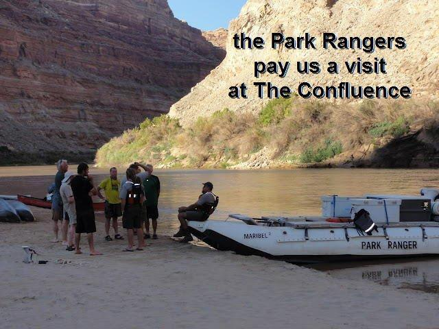
The evening silence was punctuated by the power boat visit of the US Park Rangers, who knew us as the Haggis Party, not to be confused with the innards of a sheep, which are hurled by different Scottish contestants in the games. The rangers were in search of an unregistered group of 12 on the Green, apparently not far behind us. After a nice chat, the rangers left us to our dinner.
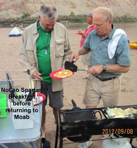
The final banquet consisted of beef stroganoff, noodles, cabbage salad, green beans and chocolate pudding. Another meal fit for a king. Eric personally cooked ham and pancakes the next morning, for his final contribution to our gastronomic wonders for the trip. It was all good.
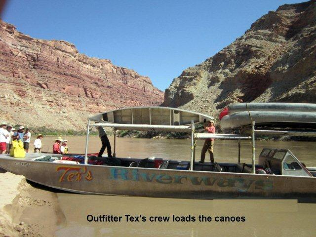
The food, water, and cooler planning was especially good, because, as predicted, we had ice left over to chill our beer and beverages for the return jet boat trip to Moab.
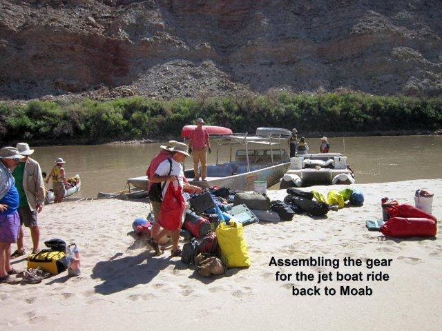

Jet Boat
It is pretty amazing to hop on a jet boat and traverse in two hours a distance equal to the miles you have paddled of the previous 5 days. But that is exactly what we did. The view of Upheaval Dome was disappointing, but that is because its best vantage point is from the air. We had a great view of the sandstone cliffs and the white bands that perforated the iron rock. The speed of the jet boat and the noise were pretty amazing, and we are lucky that no one lost their hats. We skimmed right along at a very good clip, slowing down for paddlers, and floating tamarisk branch piles. Otherwise it was full speed ahead.


We also got the chance to see more broadly the impact that the recently introduced leaf beetles had had to the eradication of the tamarisk (or salt cedar). Although transplanted to the US from the Mediterranean to help with erosion control, the water sucking tamarisk trees had been nearly impossible to kill. They have drunk up nearly 30% of the water in the American Southwest, add to that the swelling population, the need for crop irrigation, and general evaporation, that leaves near zero the amount of water that makes it to the oceans.
In many parts of the Rio Grande, San Juan, and Colorado River basins the tamarisk are dead or dying. The leaf beetles have had an amazing ability to eat into the bark and kill the plant. It is only a matter of time before the dead trees wash down river. The new shoots are all over the Bottoms, but they too, will eventually die due to the beetles and only the native cottonwood, willows and pinion will likely survive. We hope that the experiment proves successful.


Leaf Beetle & Dead Tamarisk
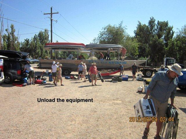
We rode the school buses back to Tex’s in Moab, recycled all of the garbage, handed over the two groovers for deposit and cleaning, paid any final bills, collected our car keys and prepared to say good- bye.
Thank you, Eric, for organizing the trip. It was a fabulous get away for all of us.
Unload and bid farewell
Until next time! 
============================================================================
The Fellow Canoeists:

Gerry Alkema, Gabe Magtutu, Ed Basehart
Steve Luhrs, Scott Soper, Jock Rystrom
Erik Rystrom, Eric Hagquist, Brian Soper,
Sieg & Doug Yoder, Stan Bajorin,
Mark Galbo, Ed Hodges, Gerry Hagquist
Bill Luhrs. Henry Hooper, Mark Welch
============================================================================
Birds Identified on the trip: 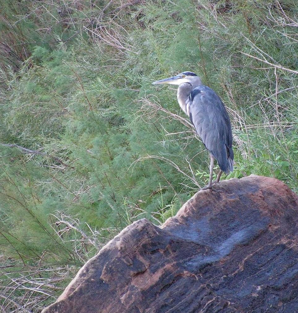
Great Blue Heron Western Kingbird
Oregon Junco Mourning Dove
Turkey Vulture Dusky Flycatcher
Yellow Warbler Spotted Sandpiper
Snowy Egret Ruby Throated Hummingbird
Mexican Duck Belted Kingfisher
Canyon Wren Marsh Hawk
Mallard Cowbird
Raven Canada Geese
Blackbird Peregrine Falcon
Magpie
============================================================================
Other Mammals Identified on the trip: 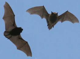
Pallid Bats
Pipistrelle Bats
Mexican Split Tail Bats
Beaver
Ground Squirrel
Chipmunk
Mule Deer
Jack Rabbit
River Otter (?)


How proud I am to have an uncle like Gabe Magtutu. His loving niece Kim.