
Hikes: PCT Oregon
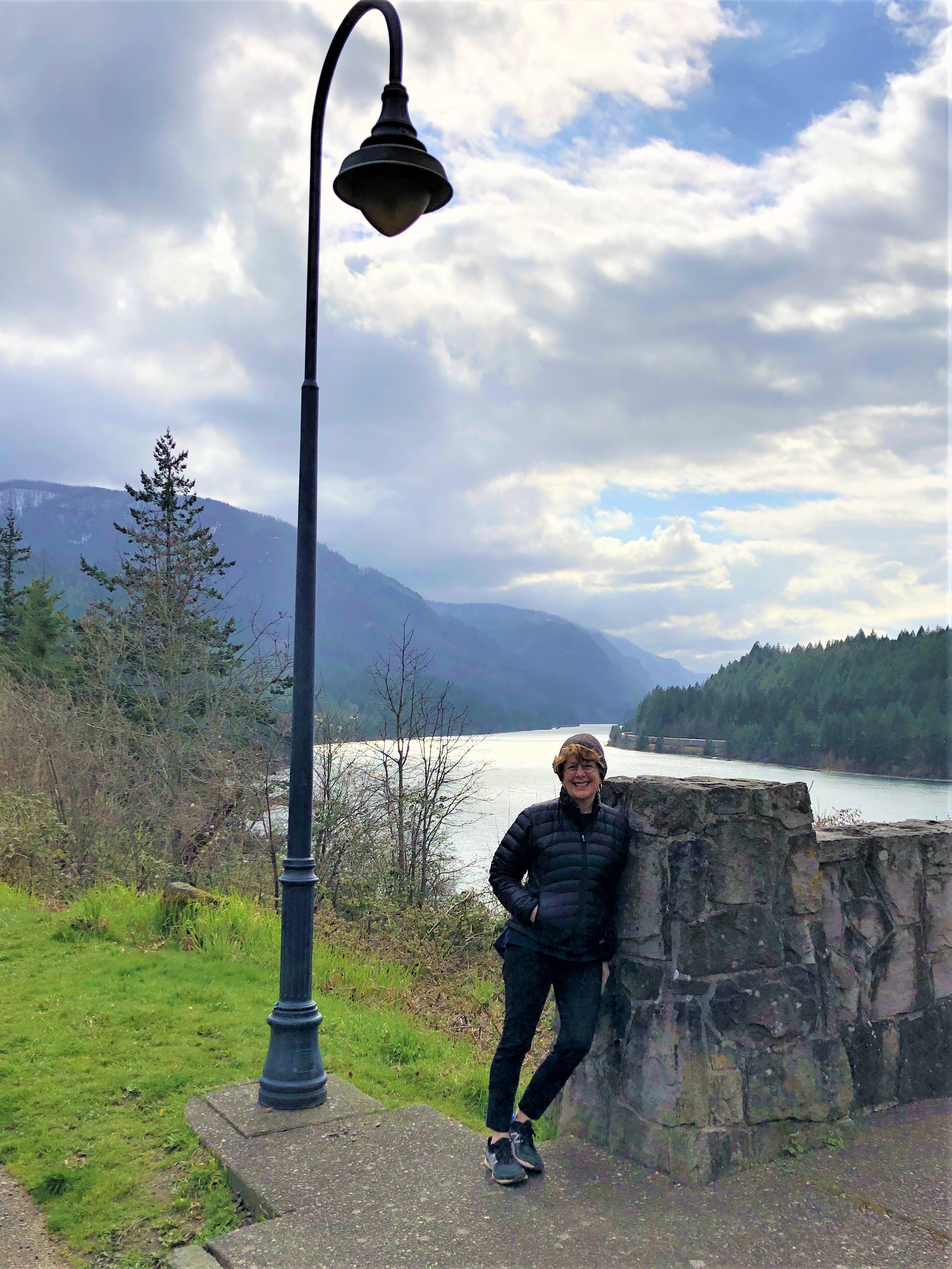
While on our post-Covid 19 Vaccine trip to Hood River in 2021, Tracy and I took some cool hikes in the general vicinity of Hood River, Oregon. One of the most surprising stretches was along the Pacific Crest Trail, going south from the Bridge of the Gods, over the Columbia River and into the Mount Hood National Forest. We had been on another section near the town of Zig Zag, and I have walked the John Muir Trail section in Yosemite, but this particular stretch was new and fun.
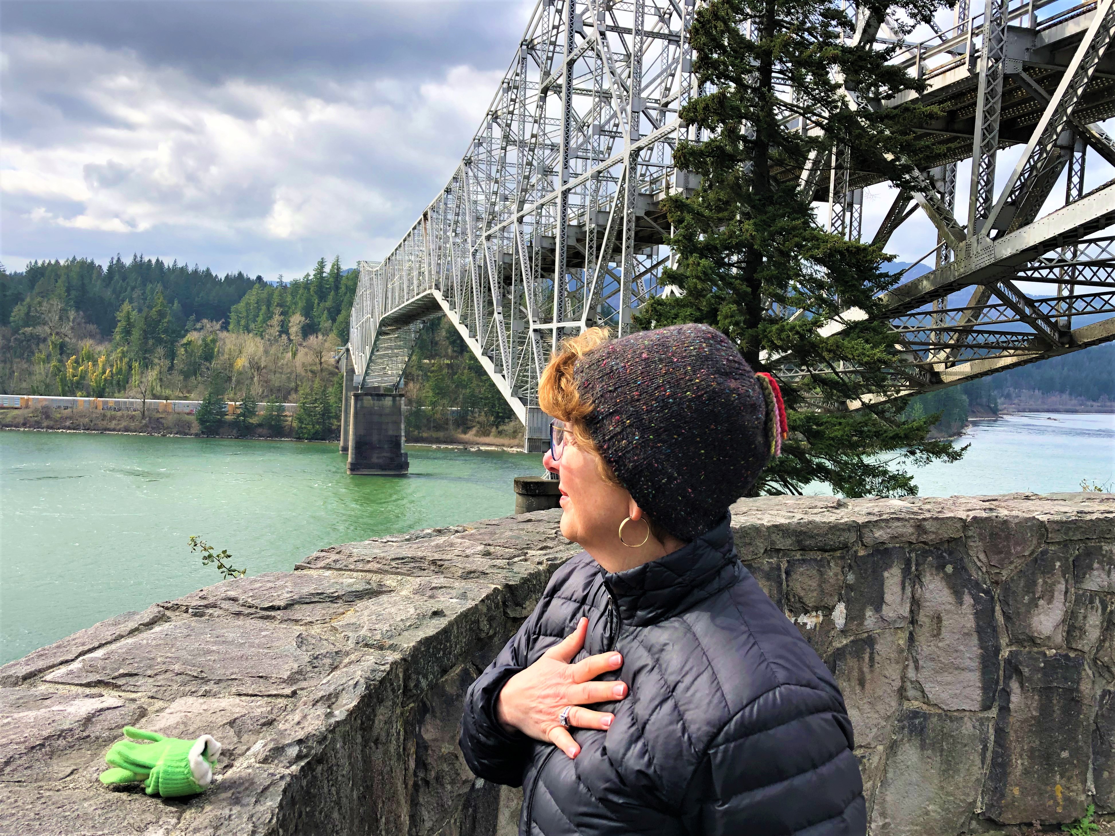
Pausing at the Bridge of the Gods, the murals on the cement base of the bridge (near visitors’ parking) were full of myth and legend. From Sasquatch to Lewis & Clark, and from Celilo Falls to the Gods at war [1], the painting was fun to explore. The challenge these days is to have public art that is not tagged by some idiot with a spray can of paint. These images seem to have missed the gang graffiti, probably because you have to be under the bridge to see it. The spot is not visible from Highway 84 or other frequently driven roads.
It was pretty cold for March, so we bundled up in layers and get ready to shed some light jackets and gloves when we were warmed up and ready to trek.


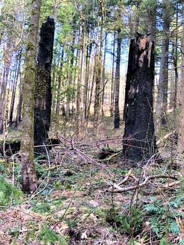
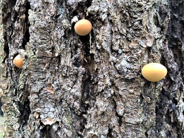
Hiking south from Cascade Locks, we travelled under US Route 84 to the Pacific Crest Trail trailhead and were immediately struck by the fire damage. All around us the base of all of the trees and the crowns of many of them were charred black from the forest fires that have ravaged the Gorge over the past few fire seasons. Seeing the trees up close was shocking, as although they were not smoking, the conflagration was devastating to the understory and the climax trees alike.


We got a good brisk walk in, before Tracy started to feel some of the side-effects of the second Covid shot. I was happy to take it easy as well, but am happy to report that we made it south for 5 miles before grabbing lunch and heading back to Cascade Locks and our car.
One of the highlights was seeing a former Lincoln High School grad, Miles Felt, who is a student at Oregon State Cascadia Campus (in Bend), and who was walking with a girl friend on the PCT. I recognized him right away and recalled that he had worked at Home Depot the last time I saw him. Tracy and I had just visited Dry Creek Falls, which is definitely worth the detour. I am happy to report that the water was flowing nicely while we were there, indicating a good sign for Bull Run and other reservoirs of drinking water for Portland and Northern Oregon.
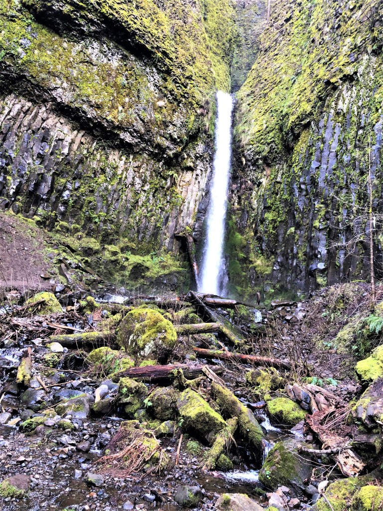

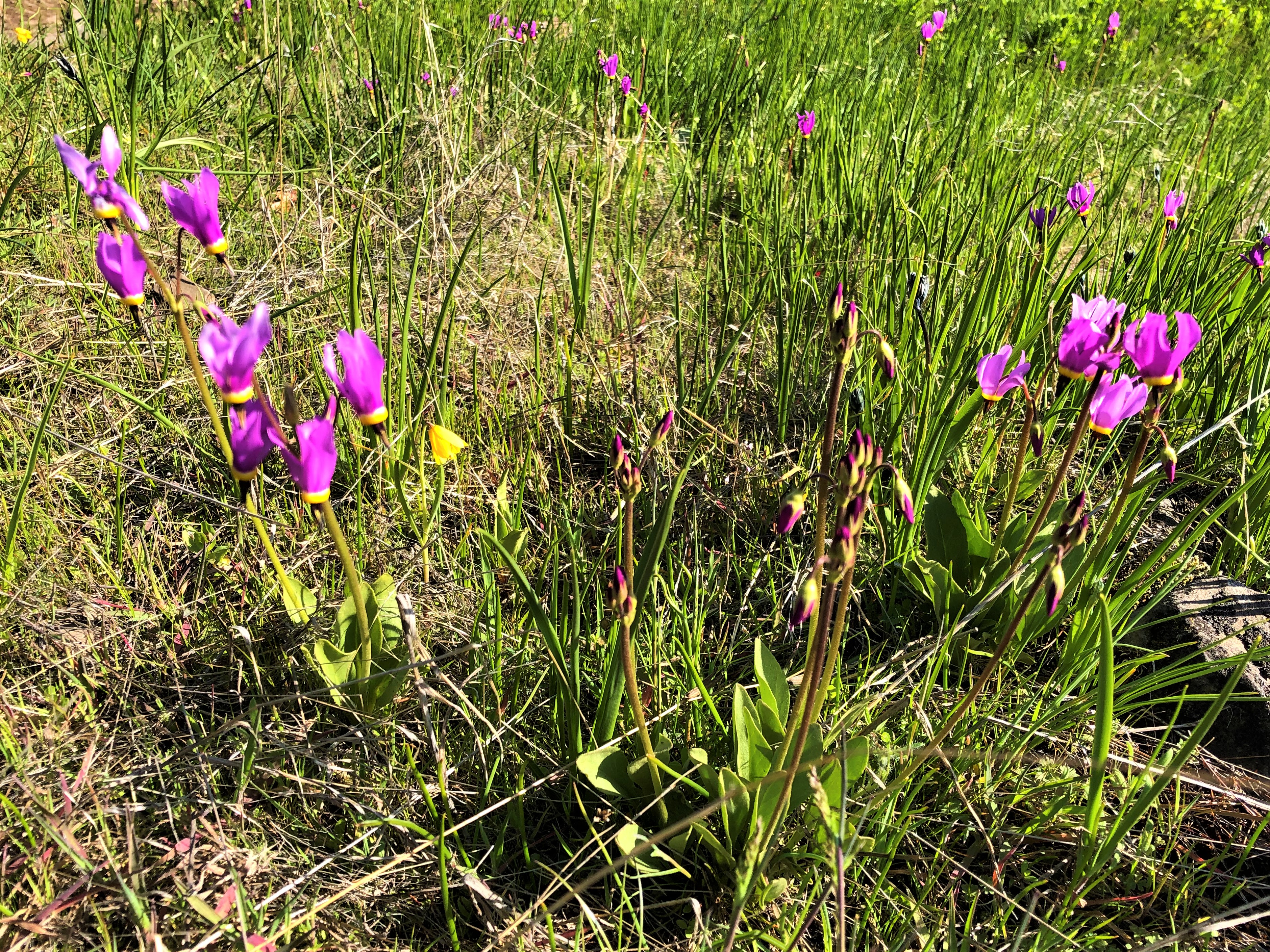
The spring flowers were visible, along with the mosses, Oregon Grape, and ferns. Not even a forest fire can keep these plants from flourishing.


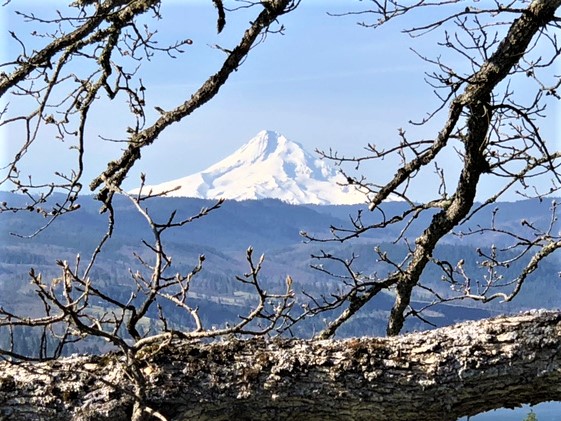
The hiking here is just a few miles away from some of the most striking views of the wildflowers and vistas of the Cascades. The primary mountain peaks in the area are Mount Hood, Mount St. Helen’s and Mount Adams, with some smaller Cascade ridges and cliffs along the way.


===========================================
[1] The story of the Bridge was written by Jim O’Connor and it is abbreviated here:
In the heart of the Columbia River Gorge, stands a 1,858-foot-long steel-truss bridge that spans the Columbia River at Cascade Locks. The Bridge of the Gods was first built in 1926 and derives its name from a much larger Landslide Bridge of the Gods that covered a part of the Columbia River in about 1450 AD. The earlier “bridge” was a blockage caused by the Bonneville Landslide, which headed on the southern escarpment of the 3,417-foot-high Table Mountain on the Washington side of the river and cascaded downward, filling the Columbia River valley with more than five square miles of debris up to 400 feet thick.
The Bonneville Landslide almost certainly gave rise to the Klickitat legend of the Bridge of the Gods. Oral tradition about the bridge tells how people “could cross the river without getting their feet wet.” Reportedly, “the river was dammed up at this place, which caused the waters to rise to a great height far above and that after cutting a passage through the impeding mass down to its present bed, these rapids first made their appearance.”
The rapids in the narrow channels became known as Cascade Rapids, a set of rocky rapids descending more than 22 feet over about 600 yards. The rapids descended another 30 feet over the next 8 miles. After blockage by the Bonneville Landslide, the Columbia River formed a great lake behind the debris dam, perhaps 300 feet deep and extending as far as Wallula Gap, about 170 miles upstream.
The Columbia eventually rose high enough to cut through and around the southern edge of the landslide mass. Still large rocky debris remained, as it was too big to be carried away by the river remained. The debris remnants created a set of foaming rapids, first mapped in 1805 by Meriwether Lewis and William Clark as “The Great Shoot.” In 1938 Cascade Rapid was drowned by Bonneville Dam.
The landslide and resulting rapids created a choke point in the Columbia River Gorge that had immediate and persistent consequences on the human use of the river. The narrowing of the river created prime fishing spots that supported Cascades and Chinookan people who settled in the vicinity of the landslide soon after the river found its course around and through the blockage. Cascade Rapid was a significant navigation hurdle, which fostered a local portage economy and occasionally violent conflicts because of its strategic location.
The 1896 completion of Cascade Locks and Canal finally permitted uninterrupted navigation between The Dalles and the coast. The constricted river valley at the downstream end of the landslide toe provided an obvious location for 20th century construction of Bonneville Dam, and, at the upstream end of the former blockage, for the present steel-truss version of the Bridge of the Gods.

